Back to Weather

5-day forecast / Van Alstyne, TX

TodayMostly Sunny91° / 76° 2%
SundayShowers And Thunderstorms Likely84° / 66° 66%
MondayShowers And Thunderstorms78° / 63° 77%
TuesdayMostly Sunny85° / 71° 2%
WednesdaySunny92° / 77° 1%

Flood Watch in Effect for Van Alstyne as Storms Approach

Van Alstyne weather, updated every four hours — local forecasts you can trust.

A severe Flood Watch is active for Van Alstyne today. Thunderstorms are likely before 1pm with heavy rain possible. Temperatures will rise significantly through the week.

Van Alstyne Newsroom

June 7, 20262 min read

National Weather Service radar for North Texas (KFWS)

Active Weather Alert

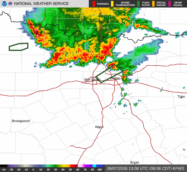
A severe Flood Watch is currently in effect for Van Alstyne, Texas. This alert was issued by the National Weather Service in Fort Worth and remains active until 4:00 PM CDT today. Residents should monitor conditions closely as the potential for flooding exists during this period.

Current Conditions and Today's Forecast

It is currently Sunday morning in Van Alstyne. The air temperature stands at 71F, with a feels-like temperature of 76F. Relative humidity is high at 93%, and the dew point is 69F. Winds are blowing from the south southwest at 8 mph, with gusts reaching 19 mph. The sky is mainly clear at this moment.

Today, the high will reach near 85F, dropping to a low near 69F tonight. There is a 72% chance of precipitation, with thunderstorms expected. According to the National Weather Service, showers and thunderstorms are likely before 1pm, followed by a chance of showers and thunderstorms between 1pm and 4pm. Skies will be mostly cloudy. The heat index may reach as high as 99. South southwest winds will increase to 10 to 15 mph, with gusts as high as 25 mph. New rainfall amounts between a tenth and quarter of an inch are possible.

Tonight, skies will become partly cloudy with a low around 75. The heat index could reach 97. South winds will persist around 15 mph, with gusts up to 25 mph.

Looking Ahead

Tomorrow, the high will climb to near 89F, with a low near 74F. The chance of precipitation drops to 2%, though thunderstorms are still listed. The heat index may reach 105. South winds will remain around 15 mph, with gusts as high as 25 mph.

Safety Reminder

With the active Flood Watch, please exercise caution. Avoid driving through flooded roadways and stay informed about local weather updates. As temperatures rise and humidity increases, remember to hydrate frequently and limit midday exertion to avoid heat-related illnesses. Check on neighbors and vulnerable individuals to ensure their safety during this period of changing weather conditions.

National Weather Service radar for North Texas (KFWS)

Sources

https://radar.weather.gov

https://api.weather.gov

https://open-meteo.com

Share

Van Alstyne Newsroom

Reporting from Van Alstyne and the surrounding area.

Related Stories

Weather

High Humidity and Heat Index Near 99 in Van Alstyne

Van Alstyne faces a humid start with a dew point of 73F. Today brings mostly sunny skies and a high near 91F, with heat index values reaching 99. Showers and thunderstorms are likely tomorrow.

Marlene OrtizJune 13, 20262 min read