Back to Weather

5-day forecast / Van Alstyne, TX

SaturdaySlight Chance Showers And Thunderstorms100° / 79° 10%
SundayMostly Sunny104° / 82° 10%
MondayMostly Sunny105° / 82° 2%
TuesdaySunny105° / 79° 7%
WednesdaySlight Chance Showers And Thunderstorms101° / 75° 15%

Heat Advisory in Effect for Van Alstyne as Temperatures Climb - Aug 22, 2 PM

Van Alstyne weather, updated every four hours — local forecasts you can trust.

A Heat Advisory is active for Van Alstyne, TX, with heat index values reaching 102 today and soaring to 107 tomorrow. Residents are urged to take precautions against dangerous heat.

Marlene Ortiz

August 22, 20262 min read

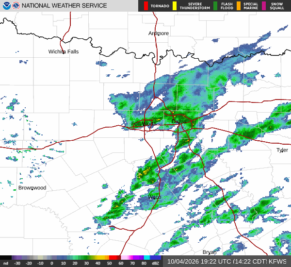
National Weather Service radar for North Texas (KFWS)

*As of Aug 22, 2 PM local time.*

Current Conditions and Alert Status

Van Alstyne, Texas, is currently under an active Heat Advisory issued by the National Weather Service in Fort Worth. This moderate-severity alert remains in effect until the evening hours today. The danger of excessive heat is immediate, with current conditions showing an air temperature of 97F. Due to humidity levels, the apparent temperature feels like 101F.

Current atmospheric data indicates a relative humidity of 37% and a dew point of 66F. Winds are currently blowing from the south at 10 mph, with gusts recorded up to 3 mph. The sky remains clear as of this afternoon report.

Forecast for Today and Tonight

Temperatures will remain dangerously high through the rest of today. The high is expected to reach near 100F. According to official forecasts, there is a slight chance of showers and thunderstorms before 4pm. After that window, skies will be mostly sunny with heat index values peaking at 102. South winds will decrease to around 5 mph.

Tonight, conditions will shift slightly as the low drops to near 79F. There is a slight chance of showers and thunderstorms between 7pm and 4am. Skies will be partly cloudy with heat index values remaining high at 101. Winds will continue from the south southeast at around 5 mph, with a 20% chance of precipitation.

Outlook for Tomorrow

The heat will intensify significantly tomorrow. The high is forecast to reach near 104F, with heat index values climbing as high as 107. Skies will be mostly sunny throughout the day. South winds will pick up slightly, ranging from 5 to 10 mph.
Overnight into tomorrow night, skies will become mostly clear. The low will settle around 82F, though temperatures may rise to around 84 during the overnight hours. Heat index values are expected to hit 109. Winds will remain south at 5 to 10 mph, with gusts reaching as high as 20 mph.

Safety Reminder

Given the active Heat Advisory and extreme heat index values, please prioritize safety. Stay hydrated by drinking plenty of water even if you do not feel thirsty. Limit outdoor exertion during the hottest parts of the day, especially between midday and early evening. Check on elderly neighbors or those without air conditioning to ensure they are safe in the rising temperatures.

National Weather Service radar for North Texas (KFWS)

Sources

https://radar.weather.gov

https://api.weather.gov

https://open-meteo.com

Share

Marlene Ortiz

Marlene Ortiz covers weather, storms, and seasonal life across Van Alstyne and Grayson County.

Related Stories

More in Sport